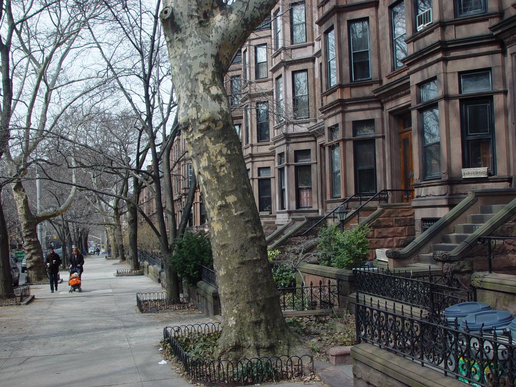
Wednesday, November 30, 2005

Vehicular Traffic


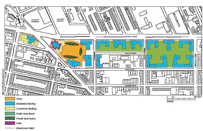
The Memorandum of Understanding (MOU) executed on February 18, 2005 between Forest City Ratner and the City and State includes an exhibit indicating proposed locations for entrances and exits for parking garages and arena/office loading. Since the project proposes to close streets on the interior, many of these access points are proposed to be located on streets surrounding the project site. Arena/office loading is proposed on Dean Street, between Flatbush and 6th Avenue; venue parking entrances and exits are proposed on 6th Avenue, between Dean Street and Atlantic.

Have the designers visited the site? Dean Street should not be treated as the rear of the project. It’s a residential street, it’s a major easterly
bike path for the Brooklyn/Manhattan route, and it’s a bus route. Both the 78th Police Precinct and the firehouse for Engine 219/Ladder 105 are located at the intersection of Dean and 6th Avenue. How will they respond to emergencies when this intersection becomes grid locked?

At the AIA presentation, there was an interesting discussion about new traffic modeling software; Stuckey suggested that the only purpose of studying traffic was to find ways to alleviate known problems. But in fact, the purpose of modeling software is to aid the design team in avoiding problems in the first place. It would provide the opportunity to study alternate scenarios, such as no venue parking.

Monday, November 28, 2005

The Stoop


Gehry spoke about the tradition of the stoop in Brooklyn, and how he hoped to use long steps to provide transitions. But the thing about stoops: they’re all about the street. The stoop mediates between the public street and the private space behind the building line. The street connects, it’s a cultural resource. One project should not take it away; it can’t easily be undone.

Saturday, November 26, 2005

Circulation

At the AIA presentation last week, the project’s landscape architect Laurie Olin spoke about how people move through the open space, and about how the design could mitigate blind corners so that people could see the space as they move through it. He presented an image of red lines on the site plan, and proposed that these represented paths of circulation. But the lines appear to have been drawn without any reference to the origins and destinations of the pedestrians. Other than dog walkers and joggers, people don’t just meander about without a destination in mind, as the red lines seemed to indicate. These paths are meaningless without reference to what people are walking to and from. It has been suggested by Matthew Schuerman in the New York Observer (see article here) that Olin’s drawing exercise was in order to allay City Planning Director Amanda Burden’s concerns about losing Pacific Street and the making of a superblock. But this response is a gross misunderstanding of the problem of towers in a park. No amount of open views in the interior of a superblock will make the ground plane function like a watched public street. A real street functions not only for access to adjacent built form but connects and integrates the immediate area into the circulation systems of adjacent areas.

It is a mark of incredible hubris for a developer to take away a public street and call it project open space. And ultimately, it is disingenuous to suggest that the street should be taken to make a better place. Why does the developer want to take the street? The developer needs to take the street in order to keep the gross square feet he is proposing within a defendable limit. Stuckey stated that the proposed density is equivalent to that proposed in the new zoning plans for downtown Brooklyn (see the Downtown Brooklyn Plan
here), But the project’s proposed Floor Area Ratio (FAR), is based upon using the taken street areas in the calculation of the project area. The intention of an FAR calculation is to limit density on private property relative to the site, with the circulation in public rights of way already factored in. Even if one were to believe that the place-making qualities of closing the street made it a good idea, the area of the street should not be used in the FAR calculation when compared to Downtown Brooklyn projects that don’t count the streets. You can’t have your cake and eat it too: calling it a public right of way for proving to City Planning that it is really equivalent to a watched street, and project open space for lowering the FAR.

NIMBY

Critics of development are sometimes accused of having a knee-jerk reaction to proposed projects, characterized as Not in My Back Yard (NIMBY). Required public services are often not desirable neighbors. Many people understand the need for homeless shelters, half-way houses, Department of Sanitation transfer stations, and the like, but don’t want them in their neighborhoods. And it is often suggested that this NIMBY attitude extends to all manner of projects, regardless of the merits. Alexandra Lange, in New York Magazine, wrote: “On one level, this is simply the mother of all NIMBY (not in my backyard) battles—since Gehry’s stadium and its accompanying towers will literally be built in some Brooklynites’ backyards. And Brooklyn’s potent, sometimes cloying nostalgia for the way things were—dese and dose, egg creams and spaldeens—can fuel a knee-jerk rage at any change at all.” See the full article here. In the same article, Gehry is quoted as suggesting that citizens’ groups “should back off when somebody knows what they’re doing”.

But to dismiss the concerns of the community as merely nostalgic and self-serving is to misunderstand the unique perspective that locals have. We know our streets better than others do, and care for our streets in a way that transcends our artistic values. Others may want great work and not care about our streets, we want great work only if we can still have our streets. Has this stopped us from getting great architecture? Maybe it’s the price we pay for having a great city.

Friday, November 25, 2005

The Proposed Site Plan by Frank Gehry


Pacific Street would be closed between Vanderbilt and Carlton and between 6th Avenue and Flatbush. 5th Avenue would be closed between Flatbush and Atlantic.

Pacific Street between Vanderbilt and Underhill looking east


Pacific Street would be closed at the end of this block.